

Table of Contents
- Their ancestors had saved themselves by climbing to the tops of mountains
- The Magades
- An irrigation system, pottery, mummies, paintings in caves, and ruins of prehistoric cities
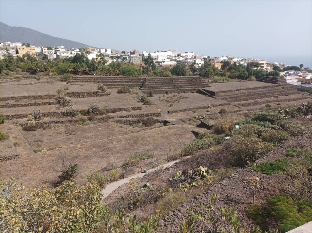
- Pyramids in Tenerife
- The dragon tree
- The Garden of the Hesperides
- Cultural paralles on both side of the Atlantic Ocean
- Thor Heyerdahl
- Sandals
- Total exterminated within 150 years
- Memories from Atlantis
- Tenerife, the island of Hell
Atlantean survivors and their descendants continued to perform simplified versions of the initiation and magical ceremonies that played such an important role in life in their homeland.
Caves for those who lived in the Canary Islands provided excellent sanctuaries for these events, as well as long-term storage places for mummies.
Descendants of survivors in the Canary Islands arranged their mummies in the crouch position, as did the offspring of their fellow ex-Atlanteans in Mexico, Peru, and very early Egypt.
Ceilings of these caves in the Canary Islands where they stored the wrapped bodies are painted red, and the walls are marked with drawings of animals and indecipherable symbols and hieroglyphics in red, gray, and white.
Atlantis: Insights from a Lost Civilization

Their ancestors had saved themselves by climbing to the tops of mountains
When the Spaniards first arrived in the Canary Islands, 20,000 people of four ethnic groups lived in the thirteen islands. The Spaniards referred to the group whose ancestors built the sophisticated buildings and canal systems as the Gaunches. They were the primary inhabitants of the islands of Gran Canaria and Tenerife. These proud people with light skin, fair hair, and blue eyes had remained independent and not intermarried with Egyptian and Carthaginian sailors and adventurers who visited them in the past.
They retained the physical characteristics of their ancestors, survivors from Atlantis. The Gaunches represented the last relatively pure Cro-Magnon stock of Atlantis—large skulls, high cheekbones, relatively long, straight noses and firm chins.
Many men were over six feet tall. They believed their ancestors had saved themselves by climbing to the tops of mountains that were the former mountain peaks of a submerged land. They were so terrified of the water they did not have boats.
Atlantis: Insights from a Lost Civilization
The Magades
The Magades (also spelled Maguadas or Harimagades/Harimaguadas) were a sect of virgin priestesses among the Guanches, the indigenous Berber people of the Canary Islands.
They served as female priestesses dedicated to worship, rituals, and religious practices, often associated with stone circles or monuments. A high priest (called Faycan) presided over them. One notable site linked to their rites was a stone circle in the Barranco de Valeron (on Gran Canaria).
A sect of priestesses, the Magades, whose practices resembled those of the witches of Mexico and ancient Europe, worshiped at stone circles. Under the power of a high priest, these virgin sorceresses engaged in symbolic dances. While hypnotized or in a trance, they served as oracles. If dreaded earthquakes shook the land, or volcanoes became active, the virgins sacrificed themselves to the ocean, hoping to prevent the omnipotent sea from covering everything as it had in the past.
Atlantis: Insights from a Lost Civilization
An irrigation system, pottery, mummies, paintings in caves, and ruins of prehistoric cities
The explorers who inspected the Gaunches’ region in 1402 found an irrigation system, pottery, mummies, paintings in caves, and ruins of prehistoric cities. The beautiful drawings Gaunche artists left on cave walls were almost identical to those painted by Cro-Magnons in southern France. Their ceramics, some dating to 20,000 B.C., were decorated with patterns similar to the designs on early South American pottery.
Another interesting find among the possessions of the Gaunches was a stone statue of a naked man carrying a globe, like Atlas supporting the world. It seemed to symbolize Mount Atlas, the magnificent mountain of Atlantis, which once appeared to be supporting the heavens as it reached into the clouds.
Atlantis: Insights from a Lost Civilization
Pyramids in Tenerife
The dragon tree
The Guanches revered dragon trees as sacred. They held important gatherings, councils of elders, and justice ceremonies under these trees.
- The trees were seen as sources of magic, wisdom, fertility, protection, and divination.
- The red sap was used in rituals, for healing (sores, ulcers, etc.), dyeing hair or objects, making shields, and in mummification processes.
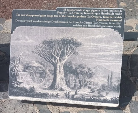
The dragon tree in La Orotava (often called the Dragon Tree of La Orotava or Franchy’s Dragon Tree):
- Visited and described by Alexander von Humboldt in 1799.
- It was enormous — reportedly around 21 meters (68.9 feet) tall with a massive circumference.
- Locals at the time claimed it was thousands of years old (Humboldt’s era estimates went as high as 6,000 years).
- It was weakened over time and ultimately destroyed by storms/hurricanes in the 19th century (major damage in 1819, final collapse around 1867–1868).
The Garden of the Hesperides
The Garden of the Hesperides (which ancient writers sometimes located in or near the Canary Islands). In this tale:
- Hercules (Heracles) slew the dragon Ladon guarding the golden apples.
- The dragon’s blood spilled on the ground and gave rise to the dragon trees.
Cultural paralles on both side of the Atlantic Ocean
Thor Heyerdahl
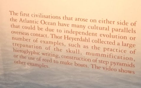
The first civilizations that emerged from either side of the Atlantic Ocean have many cultural parallels that could be due to independent evolution or overseas contact. Thor Heyerdahl collected a large number of examples, such as the practise of trepanation of the skull, mummification, hieroglypic writing, construction of step pyramids or the use of reed to make boats.
Sandals
How comes it that the sandals upon the feet of the statue of Chacmol, discovered at Chichen Itza, are “exact representations of those found on the feet of the Guanches, the early inhabitants of the Canary Islands, whose mummies are occasionally discovered in the eaves of Teneriffe?” Dr. Merritt deems the axe or chisel heads dug up at Chiriqui, Central America, “almost identical in form as well as material with specimens found in Suffolk County, England.” (Bancroft’s Native Races,” vol. iv., p. 20.) The rock-carvings of Chiriqui are pronounced by Mr. Seemann to have a striking resemblance to the ancient incised characters found on the rocks of Northumberland, England. (Ibid.)
“Some stones have recently been discovered in Hierro and Las Palmas (Canary Islands), bearing sculptured symbols similar to those found on the shores of Lake Superior; and this has led M. Bertholet, the historiographer of the Canary Islands, to conclude that the first inhabitants of the Canaries and those of the great West were one in race.” (Benjamin, “The Atlantic Islands,” p. 130.)
Ignatius Donnelly

Professor Retzius, in his Smithsonian Report, considers that the primitive dolichocephalæ of America are nearly related to the Guanches of the Canary Islands, and to the population on the Atlantic seaboard of Africa, which Latham comprises under the name of Egyptian-Atlantidæ.
W. Scott-Elliot

Total exterminated within 150 years
Although the Gaunches fought the Spaniards valiantly, the invaders and disease totally exterminated them within 150 years.
Atlantis: Insights from a Lost Civilization
Memories from Atlantis
I am in Tenerife, in the Canary Islands. I have been called here, as many paths in my life relate to Atlantis. These islands were part of that story.
Do you feel the Canary Islands are the epicenter of Atlantis memories, rather than the Caribbean?
It is not the epicenter, but one of the most important places where Atlantean people started to spread. During the last glaciation, humans moved from Africa, the Middle East, and the Mediterranean through the islands. Madeira and the Canary Islands were closest, making navigation easier. They settled here before spreading further. In my memories, the first navigators from Europe and Africa began here.
The islands we see today may not have been the same. They were likely peaks of mountain ranges, with much of Atlantis now on the ocean floor.
There are fascinating structures between the Canary Islands and Madeira, not natural formations. During the glaciation peak, water was frozen in the north, turning islands into mountain peaks. Geological eruptions occurred due to shifting tectonic plates.
If you search on Google Maps for formations between Madeira and the Canary Islands, you find square structures like streets crossing, resembling a cube from above. In my memories, this region was a main entry point to Africa and Europe, or out to the Americas. It was a navigation system for consciousness, treating the planet as a machine. These structures aligned vessels and served as portals, like the Bermuda Triangle.
The portal here is more square-shaped, not a triangle. It looks like a city from above, but too large for that. It was a grid for planetary navigation, allowing travel through energy without physical movement.
Matias de Stefano

Tenerife, the island of Hell
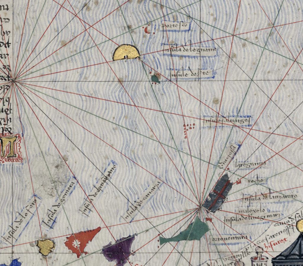
The labels in this detail from the Catalan Atlas identify the Madeira archipelago and the Canary Islands. These are among the earliest accurate depictions of the Atlantic islands on a European map.
Madeira group (upper part of the image)
Insula de Legname = Madeira (literally “Island of Wood/Timber”)
Insule deserte = Desertas Islands
Porte Santo = Porto Santo
Canary Islands (main group) From roughly east to west, the principal names are:
Insula de lanzaroto maloxelo (the dark island with the red cross) = Lanzarote (named after the Genoese navigator Lancelotto Malocello)
laregranza = Alegranza
rocho = Roque (one of the small rocky islets, probably Roque del Este)
Insula de Canaria = Gran Canaria
Insula del infernio (the green island) = Tenerife (“Island of Hell”, referring to the volcano Teide)
Insula de gomera = La Gomera
Insula de lo fero = El Hierro (also called Ferro)
Smaller islands and rocks appear with abbreviated or partial labels (for example Lobos and Fuerteventura). The coloured shapes (yellow, red, purple, green) mark the individual islands according to the atlas’s decorative convention.
These names reflect the knowledge available to Majorcan cartographers around 1375, based on earlier Genoese and Majorcan voyages.

