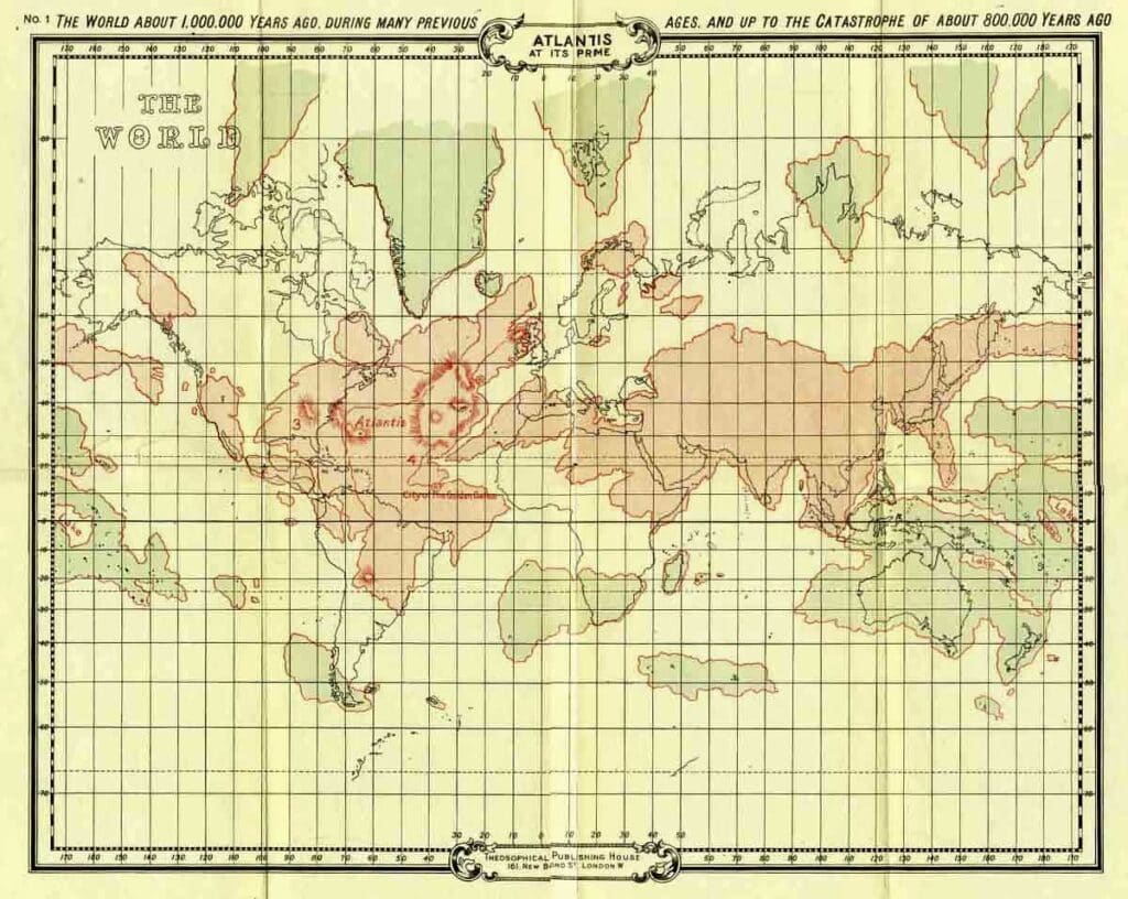
Atlantis at its prime
The first map represents the land surface of the earth as it existed about a million years ago, when the Atlantean Race was at its height, and before the first great submergence took place about 800,000 years ago. The continent of Atlantis itself, it will be observed, extended from a point a few degrees east of Iceland to about the site now occupied by Rio de Janeiro, in South America. Embracing Texas and the Gulf of Mexico, the Southern and Eastern States of America, up to and including Labrador, it stretched across the ocean to our own islands—Scotland and Ireland, and a small portion of the north of England forming one of its promontories—while its equatorial lands embraced Brazil and the whole stretch of ocean to the African Gold Coast. Scattered fragments of what eventually became the continents of Europe, Africa and America, as well as remains of the still older, and once wide-spread continent of Lemuria, are also shown on this map. The remains of the still older Hyperborean continent which was inhabited by the Second Root Race, are also given, and like Lemuria, coloured blue.
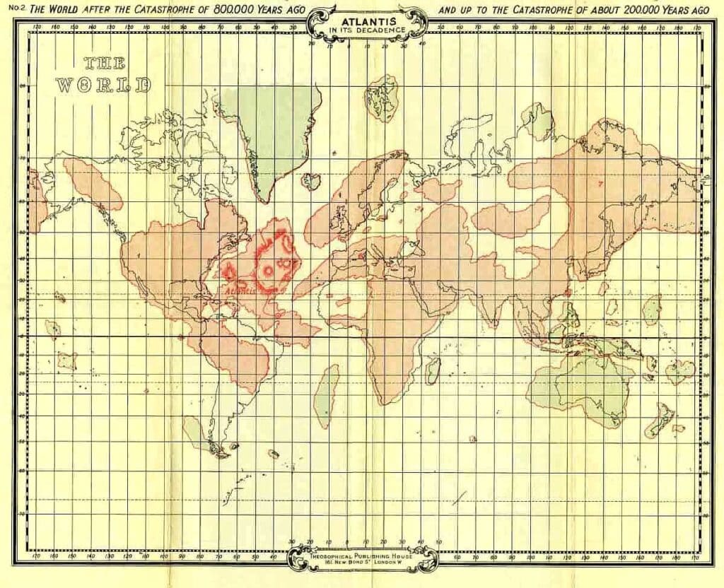
Atlantis in its decadence
As will be seen from the second map the catastrophe of 800,000 years ago caused very great changes in the land distribution of the globe. The great continent is now shorn of its northern regions, and its remaining portion has been still further rent. The now growing American continent is separated by a chasm from its parent continent of Atlantis, and this no longer comprises any of the lands now existing, but occupies the bulk of the Atlantic basin from about 50° north to a few degrees south of the equator. The subsidences and upheavals in other parts of the world have also been considerable—the British Islands for example, now being part of a huge island which also embraces the Scandinavian peninsula, the north of France, and all the intervening and some of the surrounding seas. The dimensions of the remains of Lemuria it will be observed, have been further curtailed, while Europe, Africa and America have received accretions of territory.
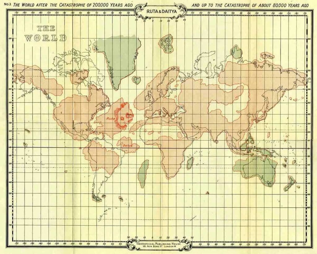
Ruta & daitya
The third map shows the results of the catastrophe which took place about 200,000 years ago. With the exception of the rents in the continents both of Atlantis and America, and the submergence of Egypt, it will be seen how relatively unimportant were the subsidences and upheavals at this epoch, indeed the fact that this catastrophe has not always been considered as one of the great ones, is apparent from the quotation already given from the sacred book of the Guatemalans—three great ones only being there mentioned. The Scandinavian island however, appears now as joined to the mainland. The two islands into which Atlantis was now split were known by the names of Ruta and Daitya.
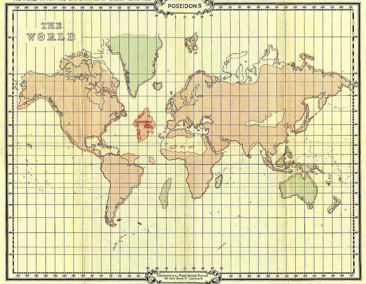
Poseidonis
The stupendous character of the natural convulsion that took place about 80,000 years ago, will be apparent from the fourth map. Daitya, the smaller and more southerly of the islands, has almost entirely disappeared, while of Ruta there only remains the relatively small island of Poseidonis.
This map was compiled about 75,000 years ago, and it no doubt fairly represents the land surface of the earth from that period onwards till the final submergence of Poseidonis in 9564 b.c., though during that period minor changes must have taken place.
Toba Explosion 70,000 years ago
It will be noted that the land outlines had then begun to assume roughly the same appearance they do to-day, though the British Islands were still joined to the European continent, while the Baltic Sea was non-existent, and the Sahara desert then formed part of the ocean floor.