Table of Contents
- The 10 most popular locations for Atlantis
- Atlantis had more than one phase
- The Great Four and the catastrophe of 75,025 B.C.
- Part one: the channeled sources
- Edgar Cayce
- Patricia Cori and the Bimini Road
- Stewart Pearce
- Tom and the Altean colony (Holroyd, 1977)
- Dolores Cannon
- Bashar
- Helena Blavatsky
- Part two: the researchers
- Plato
- Ignatius Donnelly
- Augustus Le Plongeon
- James Churchward
- The Oera Linda Book and Jürgen Spanuth
- Charles Hapgood, Rand Flem-Ath and Antarctica
- Gavin Menzies and Santorini
- Arysio Santos and Sundaland
- Graham Hancock
- Randall Carlson: the Azores as the likeliest place
- Randall Carlson: a minimum age, not a building date
- Jim Marrs
- What I take from this
- Churchward on the place of Atlantis
- A continent island in the North Atlantic
- Clarke on the shape of the Atlantic
- Clarke on volcanic islands and a sunken continent
Ask ten people where Atlantis was and you get ten answers. I have collected many of them on this site. The more I read, the more I think the name covers more than one place.
This is my master page for the question. First I list the ten places people name most often. Then I go through the channeled sources. After that I go through the researchers.
The 10 most popular locations for Atlantis
- The mid-Atlantic and the Azores. This is the classic reading of Plato, an island beyond the Strait of Gibraltar. See vitreous lava found north of the Azores.
- Bimini and the Bahamas. Edgar Cayce said parts of Atlantis would be found near Bimini. See the Bimini Road.
- Santorini and Minoan Crete. Many scholars link the Thera eruption to the Atlantis story. See the Minoan civilization as a colony of Atlantis.
- Antarctica. Charles Hapgood and Rand Flem-Ath argued that a crust shift moved Atlantis under the ice. See Where Was Atlantis.
- Spain and Andalusia. Some researchers place Atlantis in the Doñana marshes near Cádiz. See the Iberian colonies of Atlantis.
- The Richat Structure in Mauritania. This ring-shaped formation in the Sahara looks like Plato’s concentric city. See Atlantis in North Africa.
- The North Sea and Heligoland. Jürgen Spanuth placed the royal island near Heligoland. See my notes on Spanuth’s book.
- The Caribbean and Cuba. Several authors point to sunken structures off Cuba and the Yucatán.
- Sundaland in the South China Sea. Arysio Santos placed Atlantis on the drowned Ice Age shelf of Indonesia.
- The Americas and the Bolivian Altiplano. Some writers see Plato’s rectangular plain in the high Andes.
Atlantis had more than one phase
Atlantis was not one fixed place in one moment. It went through several phases over a very long time.
It expanded. Its people founded colonies on both sides of the Atlantic and in the Mediterranean.
It also contracted. After each disaster the land shrank and the survivors moved on.
So many of these “locations” may be different phases or colonies of one civilisation. Several of my sources say exactly this.
Many knew by looking at the comet that had appeared in the sky for months before the comet struck the Atlantic Ocean, creating a tsunami that was the final deluge that washed over the Atlantean islands, wiping out that civilization in the last of 3 different destructions that occurred over thousands of years to the Atlantean landmasses.
Bashar, on three distinct cycles of Atlantis

The Great Four and the catastrophe of 75,025 B.C.
Arthur E. Powell writes that the servants of the Great Four warned their people, and that floods, gas explosions and earthquakes destroyed Ruta and Daitya, leaving only Poseidonis.
The servants of the Great Four warned their people, and many escaped. Their Kings reached them in their Vimânas (aeroplanes) and led them on to the lands of fire and metal (i.e., east and north). Explosions of gas, floods and earthquakes destroyed Ruta and Daitya, and only Poseidonis remained. This was the catastrophe of 75,025 B.C.
Lieut.-Colonel Arthur E. Powell

Part one: the channeled sources
Channeled sources rarely give one dot on a map. They describe a large land that changed shape over time.
A channeled source is information received by a medium or psychic from a non-physical intelligence.
Edgar Cayce
Edgar Cayce gave his readings in trance between 1923 and 1944. He placed Atlantis between the Gulf of Mexico and the Mediterranean. More on him on the Edgar Cayce page.
The position as the continent Atlantis occupied, is that as between the Gulf of Mexico on the one hand—and the Mediterranean upon the other. Evidences of this lost civilization are to be found in the Pyrenees and Morocco on the one hand, British Honduras, Yucatan and America upon the other. There are some protruding portions within this that must have at one time or another been a portion of this great continent. The British West Indies or the Bahamas, and a portion of same that may be seen in the present—if the geological survey would be made in some of these—especially, or notably, in Bimini and in the Gulf Stream through this vicinity, these may be even yet determined.
Edgar Cayce, quoted on the size of Atlantis

Cayce on the first cycle
In another reading he described how different the map was in the first cycle.
Cayce says the Nile once ran into the Atlantic, the Sahara was fertile and inhabited, and the Mississippi basin lay under the ocean.
The Nile entered into the Atlantic Ocean. What is now the Sahara was an inhabited land and very fertile. What is now the central portion of this country, or the Mississippi basin, was then all in the ocean; only the plateau was existent, or the regions that are now portions of Nevada, Utah and Arizona formed the greater part of what we know as the United States. That land along the Atlantic seaboard formed the outer portion then, or the lowlands of Atlantis.
Edgar Cayce – Reading 364-13, on the first cycle of Atlantis
Patricia Cori and the Bimini Road
Patricia Cori channels a group she calls the Sirian High Council. She names the Bimini Road as Atlantean.
Not even the discovery of submerged Atlantean archeology (the Bimini Road) in the waters of the Caribbean Sea has received acknowledgment from scientists and scholars.
Patricia Cori, on the Bimini Road

Stewart Pearce
Stewart Pearce gives Atlantis the widest reach of all. In his account the Azores, Santorini and Crete were mountain peaks of one land.
Atlantis was much, much bigger than you anticipate. It stretched from the present eastern coastal waters of North and Mesoamerica, including the islands of the Caribbean, and stretched over what you call the Atlantic Ocean, through the Mediterranean Sea. And the islands that you know today — the Azores, Santorini, Sardinia, Majorca, Crete, etc. — were all high peaks of the mountain range that contained the Temple of Poseidon at the very spiritual heart of Atlantis.
Stewart Pearce, on the size of Atlantis
Tom and the Altean colony (Holroyd, 1977)
In the 1970s the medium Phyllis Schlemmer channelled a voice called Tom. Stuart Holroyd wrote the sessions up in Briefing for the Landing on Planet Earth (1977). When Andrija Puharich asked about Atlantis, Tom gave a location, a date and a name.
Atlantis, Tom explained in reply to Andrija's question, was a civilisation originated by a migrant group from Aksu. It had flourished for thousands of years and had come to a sudden cataclysmic end about 11000 BC. It had stretched from Greece to the Americas.
Stuart Holroyd, Briefing for the Landing on Planet Earth (1977), p. 234
Aksu, in Tom’s account, is the first civilisation on Earth, founded in 32,400 BC. So Atlantis was not one island. It was a colony that spread across the Atlantic world.
Tom also said the name Atlantis is wrong.
The name Atlantis was in fact a corruption, and it should be known as the Altean civilisation, for its people 'were of the civilisation of Altea'.
Stuart Holroyd, Briefing for the Landing on Planet Earth (1977), p. 234
Altea and Atlantis
Later in the sessions Tom made the link again.
In the Holroyd sessions Tom asks whether people know that those from Altea are the people now called Atlanteans.
'Yes,' Tom said. 'And have you known that those from Altea are those of what you call Atlantis?'
Stuart Holroyd, Briefing for the Landing on Planet Earth (1977), p. 278
Holroyd on the date
Holroyd notes that the date fits the wider record.
Holroyd calls the theories on Atlantis speculative, but says Tom’s dating fits the general view of a flood-causing cataclysm between 10000 and 12000 BC.
Now as regards Atlantis: all the theories about the nature, location and dating of this prediluvian civilisation are highly speculative, but Tom's dating corresponds with the general view that a cataclysmic event, the origin of world-wide flood legends, took place between 10000 and 12000 BC.
Stuart Holroyd, Briefing for the Landing on Planet Earth (1977), p. 239
Dolores Cannon
Dolores Cannon worked with clients under deep hypnosis. Her conclusion is close to Tom’s. More on her on the Dolores Cannon page.
I have found that Atlantis was not a single continent, city, or place. It was a name given to the world as a whole at that time.
Dolores Cannon, The Convoluted Universe, Book One (Ozark Mountain Publishing, 2001), p. 140

One of her clients still gave a clear location.
It was in the Atlantic Ocean.
P, as printed by Dolores Cannon, The Convoluted Universe, Book One (Ozark Mountain Publishing, 2001), p. 155
My notes on the book are at The Convoluted Universe, Book One.
Bashar
Bashar is channeled by Darryl Anka. He says Atlantis began with a migration through the Americas. In his account the Minoans were a later colony. More on him on the Bashar page.
Atlantis was created by a migration from Lemuria across the North, Central, and South American continents, creating what you now refer to as the American Indian civilizations that ultimately reached Atlantean shores.
Bashar, on the Minoan colony
Later colonies, such as the Minoan civilization, became far removed from the original early Atlantean style and took on some European styles.
Bashar
Helena Blavatsky
Helena Blavatsky said she received her teachings from the Masters. She placed the Atlantean root race in the mid-Atlantic.
A root race is one of the great stages of human evolution in Theosophy. The Atlanteans were the fourth.
Thus the Fourth Race Atlanteans were developed from a nucleus of Northern Lemurian Third Race Men, centred, roughly speaking, toward a point of land in what is now the mid-Atlantic Ocean
Helena Blavatsky, on her root races

Part two: the researchers
The researchers start from texts, maps and the seabed. They argue about the place, but most agree that something real stood behind the story.
Plato
Plato is the source of the name. In the Timaeus an Egyptian priest tells Solon where Atlantis lay. The full texts are on my Timaeus and Critias page.
This power came forth out of the Atlantic Ocean, for in those days the Atlantic was navigable; and there was an island situated in front of the straits which are by you called the Pillars of Herakles (Heracles) [i.e. the Strait of Gibraltar]; the island was larger than Libya and Asia put together, and was the way to other islands, and from these you might pass to the whole of the opposite continent which surrounded the true ocean
Plato, Timaeus
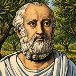
Plato already gives Atlantis an empire beyond its island. That fits the colonies idea above.
Ignatius Donnelly
Ignatius Donnelly wrote Atlantis: The Antediluvian World in 1882. He put Atlantis in the Atlantic and saw Egypt and the Maya as its offspring. See Ignatius Donnelly.
He also said Egypt was the oldest colony of Atlantis and its civilization, which along with that of the Mayans of Central America represented a primitive reproduction of the Atlantean culture.
Jim Marrs, Our Occulted History (William Morrow, 2013), Where Was Atlantis?, on Where Was Atlantis
Augustus Le Plongeon
Augustus Le Plongeon excavated in Yucatán in the 1870s and 1880s. He linked the Maya to the lost “Lands of the West”.
We must not forget that Plato informs us that the priests of Egypt assured Solon, when he visited them 600 years before the Christian era, that all communications between their people and the inhabitants of the "Lands of the West" had been interrupted for 9,000 years, in consequence of the great cataclysms, during which, in one night, the large island of Atlantis disappeared, submerged under the waves of the ocean.
Augustus Le Plongeon. Sacred Mysteries among the Mayas and the Quiches, 11,500 Years Ago (1886), p. 41
My notes are at Sacred Mysteries among the Mayas and the Quiches.
James Churchward
James Churchward wrote about Mu, a lost land in the Pacific. The passage on his page uses the name Mu for a land in the Atlantic. See Churchward’s Mu.
In our journey westward across the Atlantic we shall pass in sight of that spot where once existed the pride and life of the ocean, the Land of Mu, which, at the epoch that we have been considering, had not yet been visited by the wrath of Human, that lord of volcanic fires to whose fury it afterward fell a victim.
James Churchward
The Oera Linda Book and Jürgen Spanuth
The Oera Linda Book is a Frisian manuscript. It speaks of a land called Atland that sank in 2193 BC. Its Dutch editor placed that land in the North Sea. See The Oera Linda Book.
From this writing it appears that it was land stretching far out to the west of Jutland, of which Heligoland and the islands of North Friesland are the last barren remnants.
Introduction to The Oera Linda Book
The book also uses the sinking of Atland as a turn of its Juul, a wheel of years. That dating belongs to the book’s own story, which scholars generally treat as a 19th-century hoax. In the prophecy of the mother Frana, Sandbach’s English has:
At the time of the submersion of Atland, the first spoke of the Juul stood at the top. After that it went down, and our freedom with it.
Sandbach, The Oera Linda Book (1876), p. 115
Jürgen Spanuth took the North Sea idea further in 1953. He placed the royal island off Heligoland.
"On July 31st, 1952, this great wall was discovered at the stated spot, (9.66 kilometers) from Heligoland towards the mainland."
Spanuth, p. 108, on Atlantis: The Mystery Unravelled
Charles Hapgood, Rand Flem-Ath and Antarctica
Charles Hapgood studied old maps such as the Piri Reis map. He proposed that the Earth’s crust had shifted.
Earth crust displacement is the idea that the whole outer shell of the planet can slide over the layer below it.
Rand and Rose Flem-Ath built on this to place Atlantis in Antarctica. Hapgood himself drew a wider conclusion.
Hapgood wrote that old maps suggest a real civilization before any culture we know, either in one place with trade across the world, or spread across the world itself. Marrs prints that paragraph in the section A Worldwide Civilization. I keep one sentence of it.
This culture, at least in some respects, was more advanced than the civilizations of Greece and Rome.
Charles Hapgood, quoted by Jim Marrs, Our Occulted History (William Morrow, 2013), A Worldwide Civilization, on Where Was Atlantis
Gavin Menzies and Santorini
Gavin Menzies wrote The Lost Empire of Atlantis in 2011. He equated Atlantis with the Minoan empire and its end with the Santorini eruption. Jim Marrs covers his case on Where Was Atlantis.
Arysio Santos and Sundaland
Arysio Nunes dos Santos wrote Atlantis: The Lost Continent Finally Found. He placed Atlantis in Indonesia, on land that drowned at the end of the Ice Age.
Graham Hancock
Graham Hancock looks for a lost Ice Age civilisation rather than one island. He links it to sunken coastlines around the world. See Graham Hancock.
Randall Carlson: the Azores as the likeliest place
Randall Carlson reads Plato’s dialogues as a field guide to a real place. In a studio talk on BEST of JDP, Randall says the evidence for a great sinking of land near the Azores at the end of the last ice age is overwhelming. He also says that this alone does not prove it was Atlantis (at 2:29:38).
If Atlantis was real, this is the most obvious likely place for it. You don't have to go to all these other places and try to make it fit.
Randall
Randall Carlson: a minimum age, not a building date
He is careful with drowned ruins too. Scott Wolter showed him photos of straight stonework said to lie (18.3 to 27.4 meters) down, off Portugal. Carlson says the depth only tells when the sea reached the stones, not when they were built (at 46:08).
Let's put this into context. (27.4 meters) lower, we're talking about a minimum age of 8 to 10,000 years. So, this would have been post-Atlantian.
Randall Carlson
He adds that such a site could still be an outlying station of a larger power in the mid-Atlantic, as Plato describes.
Jim Marrs
Jim Marrs surveyed these theories in Our Occulted History. The review of the book is Our Occulted History. His summary of Cayce is a good bridge between my two parts. This quotation is a short excerpt for review and study.
In the 1920s, the “sleeping prophet,” Edgar Cayce, saw Atlantis as a continent-size region extending from the Azores to the Bahamas, with ships and aircraft powered by a mysterious form of energy crystal.
Jim Marrs, Our Occulted History (William Morrow, 2013), Where Was Atlantis?, on Where Was Atlantis
What I take from this
The channeled sources and the researchers point to the same pattern. Atlantis was large, it lasted a long time, and it left colonies behind.
This matches what I collected on the Altea region page. The full review is at Briefing for the Landing on Planet Earth. For more books on the subject, see Books about Atlantis.
Churchward on the place of Atlantis
James Churchward, in The Children of Mu (1931), places Atlantis in the North Atlantic, with America to the west and Europe and northwest Africa to the east. This is his account, not a settled geography. The quotations are short excerpts for review and study.
A continent island in the North Atlantic
Atlantis was a large continent island situated in the North Atlantic Ocean with North and Central America to the west and Europe and northwest Africa to the east. Atlantis was in existence up to within a few thousand years ago.
James Churchward, The Children of Mu (1931), chapter VI, p. 103
Clarke on the shape of the Atlantic
In 1886 Hyde Clarke published Examination of the Legend of Atlantis. He will not place a lost continent in any epoch known to tradition or history. In his account the main form of the Atlantic Ocean is geologically ancient, and the islands thrown up in his own century do not create or destroy an Atlantis.
Clarke on volcanic islands and a sunken continent
He says the concurrent opinion of geologists is against a large land being depressed into the Atlantic, and that volcanic action, even in 1811 off St. Michael in the Azores, works only on a small scale.
The concurrent opinion of geologists is that the main forms and features of the Atlantic Ocean and of the American continent must have been given to them at a most ancient geological epoch, and not in any modern geological epoch, or in any epoch of which, by tradition or history, man has cognisance. The evidence on this head may be found in details in any authority treating of the subject. So far from a large continent or large mass of islands being depressed into the Atlantic Ocean, the facts are directly the reverse, and show that volcanic action even in our time has been throwing up islands from the bottom. Except the Bermudas, which are of coral origin, all the islands in the Atlantic are the result of volcanic eruption, not peculiar to any period, but continuing to our own day. In 1811 a new island was temporarily formed off St. Michael, in the Azores, in the same way as takes place in the Mediterranean and other seas. A few years after another formation was thrown up. All these operations are on a small scale, and in few cases present permanent results. In fact, while changes are constantly proceeding they are not of a character to alter the main features or provide for the creation of an Atlantis or its destruction.
Hyde Clarke, Examination of the Legend of Atlantis (1886), p. 18