Athanasius Kircher was a polymath whose work spanned numerous fields, including geology, biology, medicine, music, and ancient languages. His broad and eclectic interests were reflected in his extensive writings and numerous contributions to knowledge during the 17th century.
Mundus Subterraneus includes several pages about the legendary island of Atlantis including a map with the Latin caption “Situs Insulae Atlantidis, a Mari olim absorpte ex mente Egyptiorum et Platonis Description,” translating as “Site of the island of Atlantis, in the sea, from Egyptian sources and Plato’s description.”
Kircher often relied on ancient texts and classical sources for his work. He was deeply immersed in the scholarship of ancient Rome, Greece, and Egypt. His knowledge of these cultures influenced his interpretations of natural phenomena and historical events.
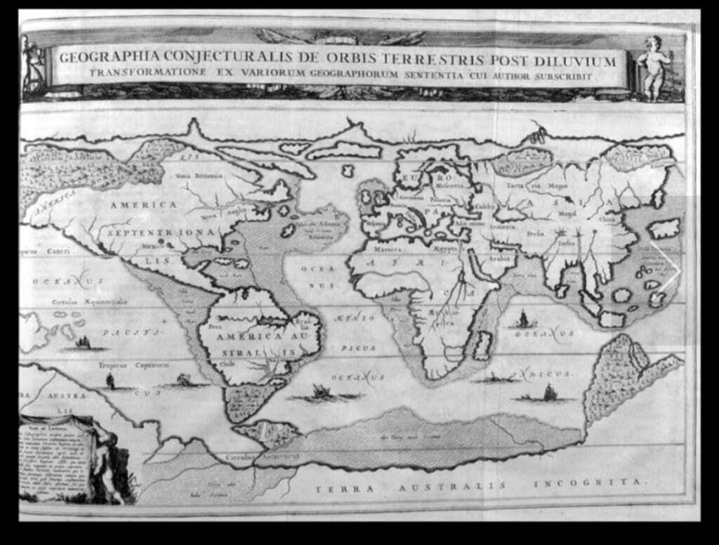
As a Jesuit, Kircher’s work was deeply embedded in the religious and theological context of his time. His interpretations of natural history and cosmology often had a biblical perspective, such as his map of the world after the Flood, which reflects the biblical narrative of Noah’s Ark and the subsequent repopulation of the earth.
Kircher was an early adopter of scientific instruments such as the microscope and the telescope. He conducted various experiments and observations, contributing to early scientific knowledge in areas like magnetism and volcanology.
Kircher was known for his ability to compile and synthesize knowledge from a wide range of sources. He drew upon the works of earlier scholars and explorers, integrating their findings into his own comprehensive works. This included using maps and geographic knowledge from explorers, cartographers, and ancient texts.
Kircher’s work often blended empirical observation with speculative and imaginative interpretations. This approach sometimes led to inaccurate or fantastical conclusions, but it also opened new avenues for thinking and inquiry.
As a member of the Jesuit order, Kircher had access to a vast network of scholars and missionaries who provided him with information and artifacts from around the world. This network helped him gather data and artifacts that informed his work.
Kircher used detailed illustrations and maps to convey complex ideas. His works were often richly illustrated, which made them accessible and engaging to a wide audience.
Kircher’s “Map of the World after the Flood” reflects his attempt to reconcile scientific observation with religious belief. It demonstrates his use of ancient sources, theological narratives, and contemporary knowledge to create a vision of the world shaped by both faith and inquiry. Despite the destruction or loss of some of his sources, his existing works provide a window into the knowledge and intellectual milieu of the 17th century.