
Table of Contents
The Nile River does not have seven separate rivers leading into the Mediterranean Sea. It has a single main channel that flows northward and forms a large delta at the sea. The delta is crossed by several distributaries and smaller channels, but they are all part of the same river system, not separate rivers.
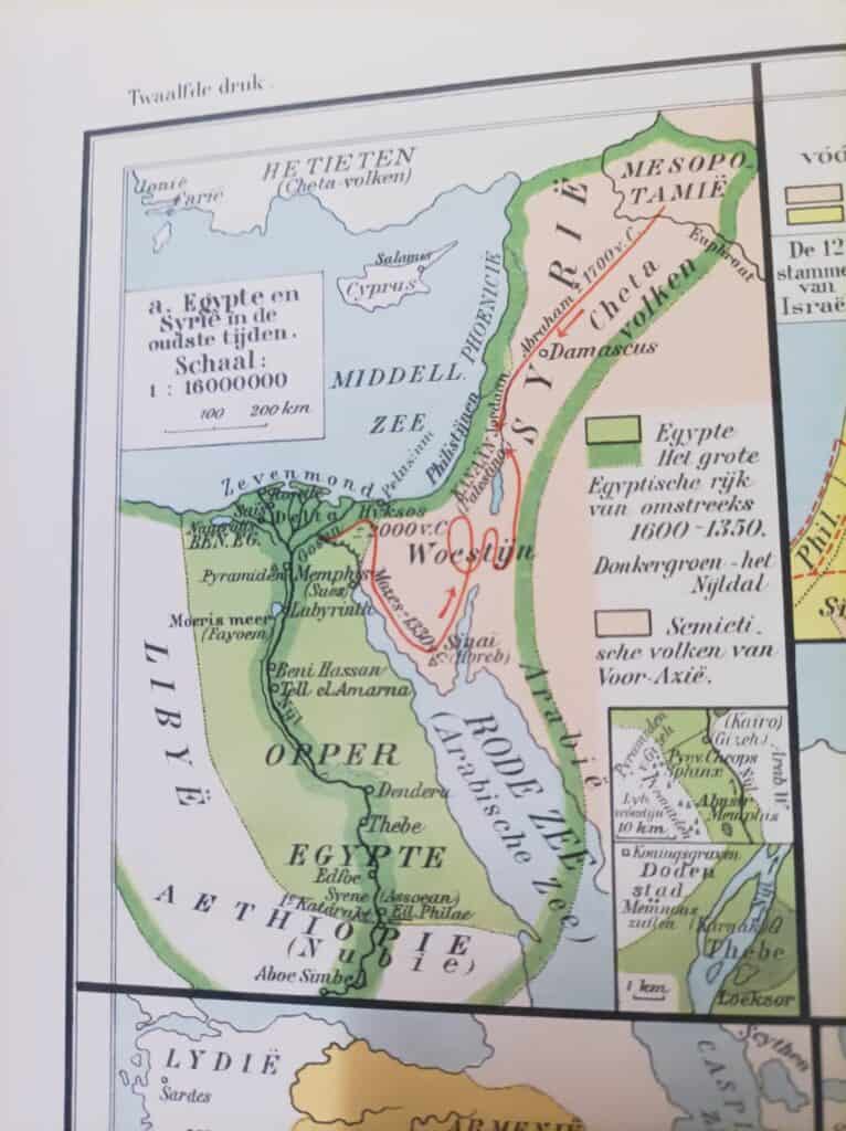
In ancient times the Nile Delta had seven main distributaries that carried the river’s water into the Mediterranean. Historical texts often cite this layout, and it shows how complex the delta was and how much it mattered to ancient Egyptian civilization.
Historical distributaries of the Nile Delta
- Pelusiac (easternmost)
- Tanitic
- Mendesian
- Bucolic (Phatnitic)
- Sebennytic
- Bolbitinic
- Canopic (westernmost)
The names come from the ancient cities or regions near the branches. Over time, natural shifts in the river’s flow, silting, and human work such as dams and canals have changed the course and number of these branches.
The idea of “seven rivers” goes back to these ancient descriptions of the delta. Today, though, there are not seven distinct rivers reaching the Mediterranean. The Nile is one river system whose delta splits into several distributaries before it reaches the sea.
Classical authors such as Herodotus, Strabo and Pliny the Elder describe the delta’s network of waterways.
Greek and Roman writers
Herodotus
Herodotus, known as the “Father of History”, writes about the Nile and its branches in Book II of his Histories.
Three natural ways and four more mouths
Herodotus names seven mouths, and says that two of them were dug by hand.
as far as the city of Kercasoros the Nile flows in one single stream, but from this city onwards it is parted into three ways; and one, which is called the Pelusian mouth, turns towards the East; the second of the ways goes towards the West, and this is called the Canobic mouth; but that one of the ways which is straight runs thus,—when the river in its course downwards comes to the point of the Delta, then it cuts the Delta through the midst and so issues out to the sea. In this we have a portion of the water of the river which is not the smallest nor the least famous, and it is called the Sebennytic mouth. There are also two other mouths which part off from the Sebennytic and go to the sea, and these are called, one the Saïtic, the other the Mendesian mouth. The Bolbitinitic and Bucolic mouths, on the other hand, are not natural but made by digging.
Herodotus, Histories 2.17, translated by G. C. Macaulay (1890)
Strabo
The Greek geographer Strabo describes Egypt and the Nile Delta at length in Book XVII of his Geography.
Two outer mouths and five between them
Strabo counts the Pelusiac and Canobic mouths as the outer two, with five more between them.
Now these are two mouths of the Nile, of which one is called Pelusiac and the other Canobic or Heracleiotic; but between these there are five other outlets, those at least that are worth mentioning, and several that are smaller; for, beginning with the first parts of the Delta, many branches of the river have been split off throughout the whole island and have formed many streams and islands, so that the whole Delta has become navigable
Strabo, Geography 17.1.4, translated by H. L. Jones (Loeb, 1932)
Pliny the Elder
Pliny the Elder also describes the Nile and its mouths in Book V of his Natural History, giving a Roman view of the geography of Egypt.
References
- Herodotus, Histories: Project Gutenberg and Perseus Digital Library
- Strabo, Geography: LacusCurtius and Perseus Digital Library
- Pliny the Elder, Natural History: LacusCurtius
Modern studies
Archaeological and geoarchaeological work has reconstructed the historical geography of the Nile Delta and how its branches changed over the centuries. One example is the Durham University Expedition to Saïs.

